Friday, March 7, 2014

Saddle Gap Trail/Saltlog Gap Trail Loop

Sometimes it is fun to try finding and hiking a trail that you aren't sure exists.

The Saltlog Gap Trail is not found on any map that I own - including the ATC's map of the Appalachian Trail, the Trails Illustrated map of this area, or the PATC Map 13.* Nobody I knew had ever hiked it, or even heard of it.  For me, it existed only as a destination on a photo of an Appalachian Trail sign at a place called Saltlog Gap that I hadn't personally experienced in about twenty years.  After seeing the photo, I was curious.  The trail must exist, or else why would it be on the sign?

(*Update: since this account was originally published, the PATC has revised Map 13 and included the Saltlog Gap Trail on the new edition, due to this report. Link.)

Although the trail is described in the latest edition of the PATC's Hiking Guide to the Pedlar District, that volume claims that the trail ends at the Blue Ridge Parkway.  The latest edition is, itself, over ten years old. The sign on the A.T. indicates a different end point than the book described.  And the book's author clearly gave up on the trail when hiking it only a short distance starting at the other end - the end the sign doesn't say the trail goes to.  He didn't appear to even try hiking it from the A.T. end.

After confirming with a source from Lynchburg's Natural Bridge Appalachian Trail Club that the trail does exist and ends at Hercules Road as stated on the sign, I made plans to explore this trail.

I decided to make this a loop hike, ascending the Saddle Gap Trail from Hercules Road to the A.T. just north of Fullers Rocks and Rocky Row, then hiking north on the A.T. to Saltlog Gap, then back down to Hercules Road. (Hercules Road is a paved forest road that ends at U.S. 501 right where the A.T. crosses the James River on the Foot Bridge.  It is often used by hikers climbing to Fullers Rocks and Rocky Row. Map and Directions.)

There is one incredibly important warning that my NBATC contact gave me regarding the Saltlog Gap Trail:

It should only be hiked on weekends!
Trailhead and parking from Hercules Road

This is because the Saltlog Gap Trail actually winds its way through an active quarry.  My interest was definitely piqued when I found that out.

0.0 Miles.  The Trailhead for the Saddle Gap Trail isn't obvious from the Hercules Road, except that it is a couple of miles up the road and has a small parking area at its start - maybe 3 cars max.  I knew I was in the right place thanks to a waypoint I loaded into my GPS and obtained from my GPS software program. There is no hiker sign; only a large boulder blocking an old road.  The boulder has a navy blue blaze painted near its base.


Trail sign near Hercules Road.
Shortly after starting up the trail, but out of sight from the trailhead, was a sign confirming that I was on the Saddle Gap Trail.  There were a couple of small stream crossings before the trail turned into an old woods road and started to climb.  After leaving the woods road at a sharp angle, the Saddle Gap Trail switchbacked gradually up the mountain, giving views through the leafless trees.

2.4 Miles. I arrived at the A.T. after about 55 minutes of hiking - 7 minutes faster than I did 20 years ago when I wrote my time on a map.  I felt good about that - I am competitive in that way.
Saddle Gap Trail ends at Appalachian Trail.  Photo shows trail's end.
After reaching the Appalachian Trail, I headed north for a little over a mile to Saltlog Gap.  The trail did not go over Silas Knob, but instead skirted the summit on its western edge, meaning shade and ice on parts of the trail.
A.T. can be a little icy on the western side of Silas Knob
3.5 Miles. At Saltlog Gap, the sign for the Saltlog Gap Trail was still there.
Saltlog Gap, looking east towards start of Saltlog Gap Trail.
Also there was a sign stating that the Belle Cove Trail is closed following a flood in June of 1995.  I knew this trail was no longer maintained as it had been washed out in a rainstorm.  It is curious, however, that there would be a sign about this trail nearly 19 years after they closed the trail.  I am left with a couple of questions - (1) whether this was the same rainstorm that drowned much of Madison County in June, 1995, within a week of when I got married.  I had always heard that the rainstorm was somewhat isolated to Madison County.  And, (2), why the forest service would be telling us not to take this trail - after all, hunters traipse wherever they want without trails, and the forest service doesn't say anything.  I have driven U.S. 501 where the trail used to end, and it is clearly still forest service land. There must be more to the story.

It is a shame the Belle Cove Trail was never rebuilt.  The previous edition of the PATC's Hiking Guide to the Pedlar District (from 20 years ago), said that the Belle Cove Trail was one of the prettiest trails in the Pedlar District.
The Belle Cove Trail is still closed.
From Saltlog Gap, I headed east looking for a trail.  It wasn't an easy search.  Leaves were down, and I could find no blazes or ruts indicating a trail.  After wandering the woods for several minutes, I saw a cut log and descended to it, and found the trail quite clearly.  If you decide to take this loop, this may be the single hardest part of the hike, and note that the trail does not follow the ridge as you might expect, but drops into a small cut in the mountains slightly north of the ridge.
Snow is great for bringing out wildlife tracks.
I am not the only one using this trail.  Bobcat?
There were several nice winter views along the trail, and the trail was both blazed and very clear for the rest of its route.
Saltlog Gap and Bluff Mountain along the A.T., as seen from the Saltlog Gap Trail.

View of the Saltlog Gap Trail, with blue blaze on tree.

The Saltlog Gap Trail winds between rocks.

Saltlog Gap Trail, on right, merges into old woods road.  
5.0 Miles. About 1.5 miles after its start, the Saltlog Gap Trail merged into an old woods road, which is marked on some maps.  This road intersected near the summit of Peavine Mountain.  Shortly after that, I came upon the one outstanding view of the hike, at the edge of an old, unused quarry.  (Don't look down!)  From here I could see the rocks that form Rocky Row, and which cut down to the James River and form Balcony Falls.  On the other side of the James, which is unseen from this vantage, are the mountains of the James River Face Wilderness, and Apple Orchard Mountain in the distance, which is the highest point on the A.T. heading north for the next 1200 miles.
View from Saltlog Gap Trail

The trail then descended to a sharp turn and came out on the edge of an active quarry.

Trail meets quarry.  Decent into quarry on right side of photo.
Trail's route through quarry.  Red line shows trail route.
5.9 Miles. After descending into the quarry in a spot marked on maps as "Slaty Gap," the rest of the hike followed the access road, which is a continuation of the road I parked on, Hercules Road.  It was hard to walk this road and not think I was walking somewhere that I wasn't supposed to be, but there was an occasional but infrequent blue blaze next to the road.
Blue Blaze along quarry access road.
7.2 Miles. And, when I came to the gate closing the road to public use, the Forest Service stated that I was welcome to walk the road.
Road is gated, but USFS tells us that Foot Travel is welcome.
I am not so sure how the Old Virginia Brick Company feels about it, though.  This company mines the area for rock that is used to make its fancy bricks.
Next to the gate, someone appears not quite as welcoming.
There was room for a few more cars to park near the gate, which is 0.2 miles from where I left my car, 7.4 miles from the start.
Parking at the end of the public portion of Hercules Road.
Here is a link to at topographic map of the hike:  LINK.

So, do I recommend this hike?  I will admit that there was a certain appeal to the hike because I was not sure where the trail would take me, and I have eliminated that uncertainty for the reader.  And I think a hike is a good one if it has an occasional view and gets my heartbeat up - others may seek more than that.  This is certainly not the first hike anyone should take in the area.  Nearby is one of the top ten hikes in the state, as compiled by Roanoke Appalachian Trail Club President Mike Vaughn (Link) - Fullers Rocks - which should be hiked first.  Also nearby is the James River Face Wilderness with 26 miles of trails - some really spectacular.  This hike presents a nice loop, however, with some unique visuals.  I plan on hiking it again during another season; just not during the week.

Hike Details:
Total Altitude Gain 2404 feet 
Total Distance 7.4 miles
Lowest point: 906 feet above sea level
Highest Point: 2748 feet above sea level
Difference: 1842 feet 
Hike Time: 2 hours, 52 minutes

Check out my other blog postings here.

Update:  I led a group hike on this same loop on December 26, 2015.  With a group, the hike took somewhat longer, 3 hours, twenty minutes.  The Belle Cove Trail sign still exists, though a meeting with the USFS last January indicated they wanted to eliminate the notice, twenty years after the trail was washed out.  The Salt Log Gap Trail remains difficult to find for its first 100 feet from the Appalachian Trail.  There is an indentation in the ground indicating a trail to the east which heads to a campsite.  The trail is to the left of that campsite, and I again found it thanks to the sawed log mentioned in this post.

Monday, February 17, 2014

Appalachian Trail south of Spy Rock

This is a description of an Appalachian Trail loop hike near Spy Rock in Central Virginia that few folks have probably ever taken.  Very few people will be encountered on these trails, so solitude is their main asset. There are no views.  But this is the only place you will find a description of a loop trail involving this part of the Appalachian Trail.  Otherwise, you will need to explore these A.T. miles by retracing your steps.  Click for Map.  If you want to check off this section of the A.T. in the most interesting way possible, this is the route to take.
The start of the Spy Rock Trail.
Most of the miles of the Appalachian Trail in Northern and Central Virginia are pretty accessible.  In Shenandoah National Park, the trail never gets more than a few hundred yards from the Skyline Drive, and it similarly hugs close to the Blue Ridge Parkway for many of the Parkway's northernmost miles before separating at Reed's Gap near Wintergreen Ski Area and heading into the Three Ridges Wilderness.  Even the Three Ridges area seems pretty accessible - it certainly is popular.  And the big climb up The Priest sees a lot of traffic, as does the great vista from Spy Rock, which I have taken kids as young as 6 to climb.

South of Spy Rock, however, the trail seems a little more mysterious.  Though it heads southwest from Spy Rock and comes pretty close physically to the Blue Ridge Parkway, there is no longer any access from the Parkway. And while there is access to the popular trails in the Mount Pleasant National Scenic Area over Cole Mountain and Mt. Pleasant several A.T. trail miles to the south, the section between Spy Rock and Cole Mountain parking is relatively untrammeled.

Access.  Access to the area is best done via the Spy Rock Trail, a woods road behind the Montebello Fish Hatchery just off of Route 56, between Crabtree Falls and the Blue Ridge Parkway.  (N37 50.518 W79 07.866.) Here is a map and directions from Charlottesville: Map. There is a parking area here, and the road is very short but pretty bumpy.  After the parking area and walking past the gate, this road services several homes along the way up the mountain, but there is seldom any traffic behind the gate.  Care should be taken to follow the trail's blue blazes, as there are a couple of spots where the road changes direction and forks, leaving a newbie potentially confused.  Where the Spy Rock Trail meets the A.T., after about a mile of climbing, there is the Trail and an old woods road to the right.  Topo maps indicate that the old woods road is an older routing of the A.T., and it parallels the trail closely for about a quarter-mile.
Looking South from the Spy Rock Trail, the A.T.
is to the right, and an old woods road is to the left.
Both routes reach Porter's Field.

1.1 Miles. Nearly every hiker heading up the "Spy Rock Trail" takes a left at this point onto the northbound A.T., heading to the Spy Rock view.  Spy Rock is near the top of the "must see" hikes in central Virginia's mountains. And I would never recommend this hike over a Spy Rock hike, though Spy Rock could be included in this hike - adding only a couple of miles.

Also contributing to the low number of hikers turning south on the A.T. is the fact that there aren't any views along the A.T. for a couple of trail miles to the south (Wolf Rocks). Nevertheless, this part of the trail has several interesting areas in addition to its wonderful seclusion, making it worth the effort to check out.  The virtually unknown trails paralleling the A.T. here create a pleasant 7.7 mile loop hike.

2.3 Miles. The trail and old road re-converge just before the trail reaches Porter's Field, an area that no longer merits that name as it isn't much of a field anymore.  But there are several good campsites in this area - in fact, camping here has been documented all the way back to 1749.  There is a reliable spring here that feeds into Mill Creek, which supplies water to the fish hatchery.  Also here is a trail that crosses the A.T. and was known as the "Railroad Trail" in an earlier version of the PATC Guide to Pedlar District Trails (2nd Edition).

Looking North near Porter's Field at the convergence
of the A.T. (left) and old woods road (right).
The same convergence, at a greener time of year.

This area is reputedly crisscrossed by many old railroad beds.  According to a source from the Natural Bridge Appalachian Trail Club (which maintains trails in this area), "There are lots of the old railroad routes in this area and elsewhere.  The railroads were temporary, and put in when there was extensive logging done just before and during the Chestnut blight infestation."  The first edition of the Appalachian Trail Guide to Central Virginia confirms this statement, stating that the "South River Lumber Company, of Cornwall, Va., built 57 miles of railroad track in an operation that extended from 1916 to 1938."

3.3 Miles.  Continuing south on the Appalachian Trail from Porter's Field, the Trail hugs the slope of nondescript Pond Mountain for just about a mile, crossing a spring, then reaching the access trail to the Seely-Woodworth Shelter.
Sign at shelter access trail on A.T.
"Loop with A.T." distance is south on A.T. - not relevant to this hike.
3.4 Miles. The Seely-Woodworth Shelter was built in 1984, and I am betting that the A.T. was re-routed at that time to come closer to the shelter.  The shelter sleeps 8, and has both a nice privy (bring your own T.P.!), and a strong spring nearby.  It is a good place to stop for lunch.
Seely-Woodworth Shelter
3.5 Miles. Retracing your steps back to the A.T., follow the Lovingston Springs Trail straight ahead. The trail crosses a stream and then takes a hard left at a signpost, shown below.  You do not want to take this hard left.  Instead take a hard right.
Sign at sharp turn on Lovingston Springs Trail.  This sharp turn was necessary
for access to shelter after it was built in 1984.  Original trail headed straight north.
Original trail can be seen behind the sign.
3.7 Miles. The short trail section just hiked was probably completed at the same time as the shelter, as the trail to the left and right is an older alignment of the Appalachian Trail. It is shown as the A.T. alignment on the PATC's Map 13, 1st Revised Edition, dated 1975, but was gone from the 2nd Edition, dated 1985. Although the trail to the right is not blazed, it is still maintained (I saw several fresh cuts on downed trees), and its route is made clear from years of tramping by previous generations of A.T. hikers. I think it may be used by mountain bikes now, given some of the tracks I saw.
View of former A.T. from Lovingston Springs Trail turn, looking north. 
4.7 Miles. The trail takes you back to Porters Field, where you encounter a cross trail just before reaching the A.T. again.  Instead of going right to the A.T., take this trail left.  It is another old railroad bed, and is labeled on older versions of the PATC map as the "Railroad Trail" (described previously).

5.4 Miles. Taking the cross trail generally westward towards the Blue Ridge Parkway eventually leads to a gate after crossing a couple of springs.  At this gate there is a very nice sign telling hikers to please not trespass. (About 20 years ago, this trail was open - though overgrown - and I used it for access to this area from the Blue Ridge Parkway.)
This gate is an important landmark, because a road meets right at that gate (on the legal side), that you will take back to the Spy Rock Trail, giving giving you a loop.  I do not recommend hiking the loop in the other direction, as it is difficult to describe how to find this trail from the Spy Rock Trail side.  On the current PATC Map 13, this trail is marked the "Boundary Line Trail."  Both the trail from Porters Field and this new trail are old rail beds, as shown on 1940 era topographic maps found on this website: Link.
The so-called "Boundary Line Trail" comes up from the left.
The trail to the right connects to the A.T. at Porter's Field.
This trail crosses a couple of couple of streams during a 1.5 mile, slow descent.  The trail drops about 235 feet over that mile-an-a-half, producing an overall grade of -3 percent before reaching a gate and leaving the National Forest.

6.9 Miles. After passing the gate at 6.9 miles (all distances are approximate), the trail passes several property access roads.  For this reason, I do not recommend following the loop in the opposite direction even though the climb is more gradual - it is confusing to find your way to the gate pictured above.  I will give detailed directions at the end of this posting, in case you want to give it a try.  But my lawyer team advises me to tell you that you do so at your own risk, and I bear no responsibility for mistakes in directions!

7.1 Miles. The road ends at the Spy Rock Trail, one of several roads converging on the Spy Rock Trail (SRT) in the same general area.  From here, take the Spy Rock Trail down the mountain, and back to the parking lot behind the Fish Hatchery.  End: 7.7 Miles.

To take the road from the SRT, head uphill on the SRT past the first convergence of roads, where the SRT takes a slight left turn.  Look for a yellow and blue sign that says "Koether." (Approximate coordinates:  N37 49.998 W79 07.852.)  The Spy Rock Trail goes to the left here; you will go right.  Several hundred yards later is a similar blue and yellow sign reading "Koether," again pointing right. This time, you will stay to the left.  This should take you to the gate shown above, with a slow climb to the shelter.

There are several trail maps that cover this area, including maps produced by Trails Illustrated (National Geographic), the Appalachian Trail Conference, and the Potomac Appalachian Trail Club.  All have some errors, but the best map is the PATC Map 13 - it is the only one showing all of the trails described above.

Disclaimer: This author is a member of the Potomac Appalachian Trail Club, volunteers for the Maps Committee, and originally sought out these trails in his capacity as such a volunteer. Nevertheless, it is my opinion that the PATC Map 13, while not perfect, is the best of several options for guiding hikers through the myriad trails of this part of the state.

Important Side Note:  This is one of those hikes you should not attempt during hunting season - on any day of the week.  Thanks to Virginia's state government, a new law passed this session allows for Sunday hunting on private property when the landowner's permission is obtained.  This hike adjoins much private property, and there are numerous additional land holdings surrounded by National Forest in this area.  As a result, it will no longer be safe for hikers and wildlife enthusiasts on Sundays in the late Autumn to enjoy areas like this.  I have no doubt that the DGIF and the hunter lobby isn't stopping there and will soon convince your representative to extend Sunday hunting to public lands in upcoming legislative sessions, effectively shutting out public lands to the "leave nothing but footprints" crowd during one of the best hiking times of the year. Please join me in registering your distress with the legislature at losing access to our hobby during a chunk of the year because others selfishly want every day of the week to pursue theirs.

Hike Details:
Total Altitude Gain 1982 feet 
Total Distance 7.7 miles
Lowest point 2766 feet above sea level
Highest Point 3944 feet above sea level
Difference: 1178 feet 
Moving Time: 3 hours, 11 minutes

Check out my other blog postings here.

Wednesday, January 15, 2014

Cole/Cold Mountain Appalachian Trail Hike


Long Mountain Wayside
I have been doing volunteer work for the Potomac Appalachian Trail Club measuring trails using a GPS receiver since May of 2013, which has cut down on the number of posts on this blog.  It doesn't mean I haven't been hiking - I have hiked more miles in the last 6 months than in any similar period in my life.  But much of the hiking I have done does not translate into interesting blog posts. I have hiked many trails I had hiked before, and a few that I had never hiked but needed measurements.  I hiked 70% of all trails and fire roads in the Southern District of Shenandoah National Park.  And now I am working on measuring trails between Rockfish Gap (Interstate 64) and the James River.

One such measuring event brought me back to the Long Mountain Wayside, which is on U.S. 60 between Amherst and Buena Vista, Virginia.  This is where the A.T. crosses U.S. 60.  (Map and Directions from Charlottesville: Link.) From here, there is a steep climb northbound to the top of Bald Knob (which isn't bald).  I did this hike two-and-a-half years ago, and it was a tough slog.  Link.  But I am in better shape now, and was looking forward to the challenge.

I take these hikes a little slower due to measuring protocols for the GPS data.  I stop at each switchback for 9 seconds, to make sure that a datapoint shows the full length of the switchback.  And I waypoint every road crossing, stream crossing, trail intersection, vista, and unusual feature along the way - stopping to measure the waypoint for at least 30 seconds.

At the summit of this hike, I found myself on top of Cold Mountain (also called Cole Mountain - I wish somebody would just decide one name or the other!)  Cold Mountain has one of the truly great vistas in Virginia, as the Natural Bridge Appalachian Trail Club mows the summit, keeping trees from taking over. Thank you NBATC!
And even though I know that Cold Mountain has a really great vista, it still takes my breath away every time I see it.  This time, I had a smartphone app called "Peakfinder" that helped me identify many of the peaks I could see from the summit.  Above are captioned photos showing that I could see mountains all the way from Trayfoot in Shenandoah National Park in the north, to McAfee Knob near Roanoke in the south.  

Dark Pine Forest on the Old Hotel Trail
You don't have to travel the hard way to see this vista like I did, though.  Most folks drive to a parking lot much closer to the summit.  Directions to that lot are provided by Bryce over at Hiking Upward.  I have taken pre-school kids up the mountain from the parking lot described in that post.  Be sure to bring a kite!

From the summit, I followed the Appalachian Trail north to the parking lot above, which is on Wiggins Spring Road - a Forest Service road.  Access to this spot from U.S. 60 is well maintained and well marked by the Forest Service.  A short walk down the road brought me to the Old Hotel Trail, which is a 3.5 mile trail back to the A.T.

Wolf Tree on the Old Hotel Trail
 The Old Hotel Trail makes a popular 5.8 mile loop with the A.T. over Cold Mountain that is moderately difficult and described by Adam and Christine at Virginia Trail Guide - with their typically fantastic photos taken at a prettier time of year.  Christine accurately estimates this to be about a 3 hour hike for most folks.

The Old Hotel Trail passes a giant Wolf Tree - a White Oak, in an area that, if it was near a spring, would be the single greatest campsite in Virginia.  I have camped there with my son's Boy Scout Troop (Link).

After hugging the side of Cold Mountain, the Old Hotel Trail crosses a stream then marches past the Cow Camp Shelter - one of the A.T. thru hiking shelters - before returning to the A.T. at Cow Camp Gap.
Bald Knob from the Old Hotel Trail
There is an old trail that continues past the A.T. at this point, and ends at one of the access roads.  It is no longer blazed, and I am not sure it exists anymore, but I could see it from the A.T.

While climbing Bald Knob again on the A.T. returning to my car, I could hear a fighter jet streaking through the sky - something that is a pretty regular occurrence down this way.  The dog would freeze at the sound, and I would scour the now cloudy sky.  I briefly saw the plane at one point, banking sideways around a mountain at a lower elevation than we were hiking.

Near the top of Bald Knob I came across wreckage from an earlier training mission.  The current AT Guide to Central Virginia says the remains are from a Navy Fighter jet that crashed in October, 1978, killing two occupants.  The guide also states, “Physical evidence of the crash is now barely discernible.” You can judge from the photo below whether that statement is accurate.

Cow Camp Shelter
Airplane wreckage
Hike Details:
Total Altitude Gain 5515 feet 
Total Distance 14.2 miles
Lowest point 2082 feet above sea level
Highest Point 4118 feet above sea level 
Time: 5 hours, 54 minutes

Check out my other blog postings here.

Thursday, December 12, 2013

My GPS Manifesto

There is nothing that can bring out passionate hikers than the question, "do you use a GPS?"  Predictably, there is a tsunami of responses that accuse GPS users of being clueless about their location in the woods and unable to use a map and compass.  And it makes some GPS users defensive, like this blogger.

I think the haters are ignorant.

Let's get one thing straight: nobody loves maps more than I do.  I have been collecting them since at least the third grade, and by age 10 could spout for a half hour about which gasoline companies produced the best road maps.  (I am pretty sure that I am solely responsible for gas stations charging for maps - I would always clean them out when on family road trips.)  I have several maps on the wall in my office, ranging from a relatively new map of the entire Appalachian Trail to an 1855 map of the United States that measures 4 feet by 5 feet.  I treasure the framed 1842 map of the United States over the piano at home.  I am a volunteer for the local trail club's Map Committee.  And I teach map and compass to the Boy Scouts.  In short, I can map and compass circles around most hikers out there.

And I love my handheld GPS.

I never go on a hike without my GPS.  I also take a map and compass.  I use both.  But those who accuse GPS users of having suspect skills are plain wrong.  Both tools have their place.  I don't bring a GPS to help me in case I get lost - a good use of the maps will keep me from getting there.  But there are times when I need an assist and the GPS has helped.  An example is coming down Mt. Lafayette in New Hampshire on the A.T. last summer.  Mt. Lafayette is the tallest mountain in the state not found in the Presidential Range. The top of the mountain is a boulder field.  It is a little harder to find your way there than it is when following a dirt path through a grass covered southern bald.  When I got off course there, my GPS told me to head to the right 20 feet to get back on the trail.  No amount of map and compass expertise is going to tell you that.
Backpacking in the White Mountains,
with my trusty GPS clipped to my belt.
So what is it that gets some hikers riled up about GPS use?  I think there are several things, ranging from elitism to a concern that some hikers out there are not prepared to explore the wilderness.  But I also think a lot of them equate a handheld GPS with the units people have in their cars.  (Which, by the way, I do not have in any of the family cars.)  Listen folks, a handheld does NOT tell you to turn right in 300 steps!

So what is the point of the GPS?  I keep a library of my data.  That way, if I return to a trail I can have a record of how long it took to complete the hike the last time I hiked it.  And I have a record of how long a drive takes to the trailhead.  And I have a record for the IRS in case they ever question the volunteer miles I have driven.  And I can analyze data to get a sense of whether one hike is harder than another.

I have not been blogging much this year, even though I am on pace to set an annual record for most miles hiked.  Much of my time has been spent measuring trails for the Potomac Appalachian Trail Club, using my GPS to increase the accuracy of their maps. The group that is currently obtaining GPS data for each trail in the club's 19 maps.  This has gotten me back on several trails I hadn't hiked in two decades, and added considerably to my own library of GPS trail data.

Several of my colleagues have purchased new Garmin GPS units recently, and I have given them some advice.  It has me thinking that I should go live with a GPS blog - there aren't that many out there, and a new GPS requires a learning curve.  So I am putting out information on that blog specific to learning a new GPS. Check it out!  LINK.

Tuesday, December 10, 2013

Appalachian Trail through Mountain Lake Wilderness

Near Roanoke, the A.T. leaves the Blue Ridge and enters an area of Virginia known as the Valley and Ridge region.  This area is characterized by long folds in the land, creating mountains that look more like large, dead snakes than sharp peaks.  Hiking this region consists of relatively short, steep inclines, long periods with little elevation gain, and steep descents, before crossing a stream valley and doing it all over again.

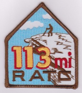
The Roanoke Appalachian Trail Club led a hike on the first Tuesday in December of one of the sections of A.T. they maintain.  The club has divided up the 120 miles of A.T. they maintain into 14 different sections, and I have done the first eight.  Because it is such a long trip from Charlottesville, I convinced them to allow me to drop my car further up the trail so I could combine their Hike #9 and their Hike #10.  If you are a RATC member and hike all 14 sections, you can earn a patch for your backpack, which I believe shows a blind man about to fall to his death off of McAfee Knob!

After an 8AM meetup with the group at their usual carpool spot - a place called the Orange Market near Roanoke, I dropped my car just of of Virginia Route 42 in a parking lot on a back road.  From there, I joined a carpool to the trailhead, on Route 635 near the town of Interior, Virginia. (Map and directions from Charlottesville: Link) This is really, really remote area!

This is a solid bridge!
We started at 9:48 AM near the edge of the Peters Mountain Wilderness at a parking lot with a large kiosk featuring a map of the area.  We were on the A.T. after a 100 yard journey on a side trail, and wound somewhat mysteriously over hills and streams, only to cross a large bridge over Big Stony Creek and then the same road we came in after 2 miles, and 40 minutes, of hiking.  I can only think that the road itself used to be designated the A.T., and a large amount of work was needed to get it off the road and hugging some steep slopes.

By the time we crossed our road, one other hiker and I had left the 3 others in our group, but my colleague lost steam heading up our first mountain, called "Big Mountain."  After heading back down the slope to check on him, then waiting for him for several minutes at the Bailey Gap Shelter at the 3.6 mile mark, I moved on, knowing that there were members of our group on either side of him.  I knew that daylight was precious, and I would never make the required distance before it got dark if I waited too long.

Bailey's Gap Shelter
The A.T. never seemed to find the top of Big Mountain, preferring to travel along the mountain a couple hundred feet below the ridge line.  It appears from maps that the A.T. once topped the mountain, but it used a woods road, and likely the trail is now off of the ridge to avoid that road.  This section was pretty rocky, so the going was relatively slow.  After 7.2 miles, I entered into the Mountain Lake Wilderness and quickly came across a couple of large outcroppings with wonderful western views.  At one of these outcroppings, called Wind Rock, was the rest of the group, heading southbound on the trail to swap keys with the northbound group.  They were having lunch, and I stopped to check in (briefly) and let them know that the other hiker would have to take the shuttle car, rather than my vehicle.

The Warspur Shelter looks a lot
like the Bailey's Gap Shelter.
Unfortunately, after leaving Wind Rock, I followed the Potts Mountain Trail rather than the A.T.  Figuring that blazing was at a minimum in the wilderness area, I realized my mistake when I pulled out a map to confirm. Fortunately, the A.T. parallels the PMT only a few hundred yards downhill, so I was quickly on the correct trail. Once headed in the right direction, there were few rocks and the trail flew by.  I stopped only to drink water out of streams via my Sawyer Mini Filter - I forgot a water bottle and didn't have time to buy one at the Orange Market. The filter required me to suck directly from the stream, so I had to stop progress to hydrate.  The Sawyer Filter worked great - it is really an incredible instrument, adding only a couple of ounces to my pack's weight.

I stopped a couple of times for water near the Warspur Shelter.  (Really, I just like writing that. What a great name!)  Then I flew downhill past a parking area where my fellow hikers would end their hike, and started back up the A.T., hiking past Rocky Gap to the summit of Johns Creek Mountain Trail.  This was a really tough climb! It averaged at about 20%, and was 15 miles into my journey, so I didn't have a lot of extra gas on this ascent.  

The trail signs in here were really old.  Several had mileage for the a former Big Pond Shelter painted over, and when I later researched this shelter, I discovered that the Big Pond Shelter was moved to the present location of the Laurel Creek Shelter way back in 1988! So these signs are clearly over 25 years old, and they definitely look it.  I thought the first one I came across was bad, but the sign at the junction with the Johns Creek Mountain Trail is nearly unreadable!
At what point is a trail sign beyond its useful life?


Once at the top of John's Creek Mountain, 16 miles into my hike, I knew I had passed the last tough mile.  It was level for another 1.5 miles, then steeply downhill with only a few uphill portions, almost all the way to State Route 42.

The last mile of this was through rolling fields in increasing darkness.  And, just before 42, was a flowing stream in the grass, ankle deep, that successfully soaked both of my feet.  No time to go barefoot!

I crossed 42 and then cruised the last 3/4 mile through fields, allowing me to see the trail despite increasing darkness.  When I reached a stone covered trail in a forested section, it was time to fish around in my backpack for a headlamp.

It turns out, I spent more time finding the headlamp than using it, as I was only 100 yards from the road where I was parked.

I would not rate this as an exciting hike, but I was moving so fast that I failed to stop at either of the major overlooks - Wind Rock and Kelly Knob.  I might feel differently if I broke this hike into two parts.

The longest part of the trail seemed to me to be the section between the Laurel Creek Shelter and Rt. 42.  I was concerned about light, and it was near the end of the hike, which no doubt contributed.

The hardest part of the hike was heading up John's Creek Mountain after crossing a dirt FS Road (Va 601) at Rocky Gap on an old dirt road that goes straight up John's Creek Mountain - a 20% grade over 15 miles into my hike.

Below are the numbers for the entire hike, first with a GPS screen shot taken at the end of my hike. Interestingly, the computer program (shown below that) generates slightly different numbers, and I am not sure the cause of the discrepancy.

.Inline image 1

My GPS Data:
PATC Difficulty Factor497.0
Total Altitude Gain5626feet 
Total Distance21.96miles
Low Point2153feet above sea level
High Point4183feet above sea level
Time of Hike7:55hours: minutes

Be sure to check out other posts at Wandering Virginia.

Friday, October 11, 2013

A.T. Near Roanoke: Lee Hollow (Rt. 621) to Trout Creek (Rt. 620)


Here is another set of photos from an A.T. hike I took back in the Spring with the Roanoke Appalachian Trail Club in Craig County.  This section of trail passes by the Audie Murphy Memorial, close to where the pilot crashed into the mountain back in 1971.  A good read on the monument and the trail is found here: Link.

The hike started on Virginia Route 621, where there is parking for about 12 cars.  It ended also on Rt. 621, where it meets Rt. 620.  We parked here because of a stream crossing on 620 - the trail leader did not trust the privately owned bridge over the stream to hold a car!  The hike was 9.3 miles long, was hiked in just under 3 hours 50 minutes, plus about a half hour stopped.  Minimum elevation: 1488 feet.  Maximum elevation: 3120 feet.

The hike, heading northbound on the A.T. starts by traversing the Brush Mountain East Wilderness, a new (2009) wilderness on the north side of Brush Mountain.


Thursday, October 10, 2013

A.T. Near Roanoke: Sinking Creek to Lee Hollow


Here is a set of photos from another section of the A.T. near Blacksburg.  This is the southernmost portion of a continuous section of the A.T. I have hiked into Maryland.

This section's highlight landmark is the 300 year old Keffer Oak, shown below in the 2nd photo.  Some say it is the largest oak on the entire A.T.  Others say one in New York is larger.  Still others say they are each about equal.

The hike started on Virginia Route 630, where there is parking for about 6 cars.  It ended at a larger parking lot on Virginia Route 621.  The hike was 10.4 miles long, was hiked in just under 4.5 hours, plus about an hour stopped.  Minimum elevation: 1535 feet.  Maximum elevation: 3522 feet.


Wednesday, October 9, 2013

Rivanna Redux

I accompanied my Boy Scout Troop on its annual 20 mile hike around Charlottesville this past weekend.  (I say "my troop" because I was recently named Scoutmaster.)  We had 6 boys complete the entire 20 miles, and one boy join after 7 miles, a second join after 8.5 miles and a third join after 10 miles.  

The troop did a similar Rivanna loop almost exactly a year earlier, described here: Link.  This year we did it counter-clockwise, while in 2012 we did it clockwise.


Why do the Rivanna Trail?  It really isn't very interesting compared with a lot of trails within an hour of Charlottesville.  But there are several reasons.  Number one: it is open!  Shenandoah National Park is currently closed.  But more important, it is pretty flat, which is good when boys need to get 20 miles for their Hiking Merit Badge.  And the badge requirements don't differentiate between flat land and mountainous trail when it says "20 miles."  Another great thing is that is near where all the scouts live, and the group is always accessible by cell phone.  So we had the option of getting a hurt hiker picked up (which didn't happen this year), adding boys along the way who had sports or work commitments that morning, and setting up refreshment stations along the way. (Thank you Ms. Troyer!)

This year, we even had a couple of mock first aid incidents along the way, set up by one of the parents who is a nurse.  (Thank you Ms. Vincel!)

I still remember my 20 miles as a boy, fulfilling my Hiking Merit Badge requirement.  It was on the Blackhawk Trail, along the Rock River in Illinois.  There were two high points - at the Blackhawk statue overlooking the Rock River, and at another spot called "Whirlpool Rock."  I am glad to see the trail still exists.  I hope one of these boys has similar feelings about the Rivanna hike when he is an adult.

I don't recall seeing another hiker (other than folks walking and biking the Riverside Trail portion), but we did see three mountain bikers.  There was a tent just off the trail near the 5th Street Holiday Inn (homeless perhaps?)

Our route was slightly different than last year, as can be seen by the map below.  2012 is in purple, and 2013 is in blue.  On the south end, we took trails around the Willoughby subdivision - public, but not actually part of the Rivanna Trails system (thanks to a parent familiar with these trails).  I had never done this part of the hike before, so it was my favorite.

Also unlike in 2012, we didn't follow the trail to its dead end north near Greenbrier Elementary School because we knew we would get close to 20 miles without adding that street/trail combination.  And we didn't take the trail between Emmet Street and Barracks Road because we couldn't cross Emmet safely - UVA football traffic was heading back north, and the crosswalk signal was not working.  

Overall, however, the trips compare remarkably well.  Comparing numbers from each year:

2013: 19.8 miles, Moving time: 7:30; Stopped time 2:03; Moving average: 2.6 mph
2012: 20.4 miles, Moving time: 7:31; Stopped time 2:09; Moving average: 2.7 mph

It is interesting to see that moving and stopped times are virtually identical.  We moved faster in 2012, which accounts for the additional half mile hiked in 2012 over the same time length.  There is a Scout saying that "you only travel as fast as your slowest hiker."  Our hikers were generally the same as in 2012, so I expected a slightly faster pace.  One of the other leaders claims we had a faster pace setter for the last part of the 2012 hike, which would explain our slower pace this year.

The ugliest part of the hike is the street walk at about 4:00 on the clockface above.  Today, the local news reports police are investigating a possible Meth Lab on a street we walked on Saturday.  I am glad they weren't investigating that on Saturday when we were walking by!