 |
| Brown Mountain Creek Shelter with an A.T. thru-hiker. |
From U.S. 60, I headed south and down the mountain to the Brown Mountain Creek A.T. Shelter. This part of the hike is totally wooded, without views. There is a sign along the trail telling hikers to look for signs of an old community that was down here. People farmed the area until the land was sold to the Forest Service back in the 1920's. Foundations were clearly visible off of the trail.
 |
| Gracie the Hiking Dog checks out the bridge at Brown Mountain Creek. |
After finding a geocache near the shelter I started the long climb back up. The shelter is at about 1500 feet above sea level, and over the next several miles the A.T. climbs up to over 4000 feet in elevation. So this is a long haul hike when started from the shelter, almost as long as the hike up the Priest. I felt my previous inactivity! I was ready to reach the top of Bald Mountain, and was hurting for several days after this hike.
There were lots of hikers on the trail, which was surprising for a Thursday in May. I ran into at least 5 thru-hikers, and a couple of section hikers. I think I was the only day hiker out there. I mentioned my purpose to a couple of section hikers - to check out possible campsites for a Boy Scout backpacking trip - and got some really good advice, as one of them was a leader of a Richmond troop.
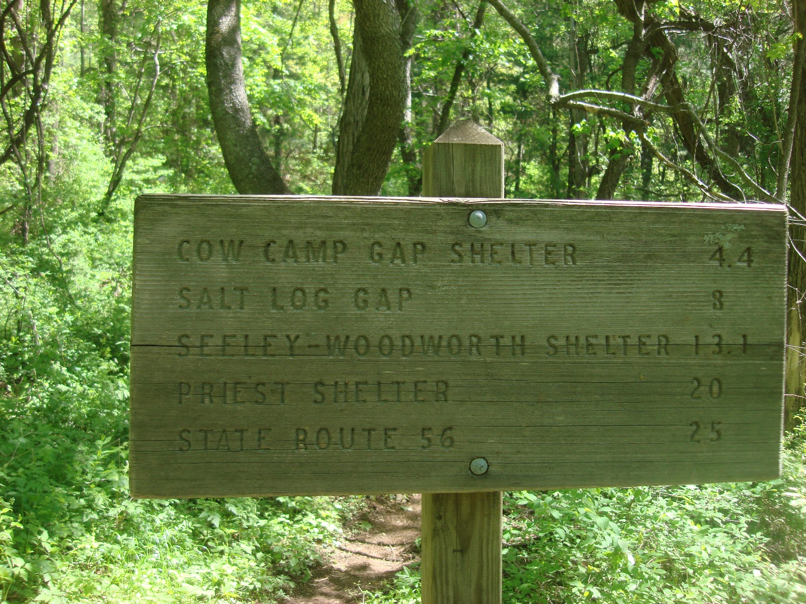 |
| Trail sign for northbound hikers at U.S. 60. |
 |
| Trillium in bloom at 3000 feet elevation. |
 |
| Near the top of Bald Mountain. |
But hiking this section gives me a taste to go back and re-hike sections I haven't hiked in nearly 20 years. Too bad the heat has arrived in Virginia. Today's forecasted 95 degree Memorial Day temps leaves me little incentive to head up into the mountains!
 |
| Elevation Profile |
Hike Details:
PATC Difficulty Factor 236.1
Total Altitude Gain 3010 feet
Total Distance 9.3 miles
Lowest point 1388 feet above sea level
Highest Point 4049 feet above sea level
Time: 4 hours, 51 minutes