A somewhat hard-core guide to a random selection of the Commonwealth's lesser known hiking trails, by a central Virginia based 10,000+ lifetime mile hiker, backpacker, bushwhacker, explorer, Scoutmaster-emeritis, GPS data addict, and Appalachian Trail maintainer.
Sherando Lake and beach from Torry Ridge.
The Blue Ridge Parkway runs along the ridges in the background.
Thursday, June 30th looked like the best weather day for some time to come, so the dog and I dropped my son off for camp at 7:45 then headed out for Sherando Lake, south of Waynesboro and west of Wintergreen Ski Resort. Sherando is probably the most popular place in the entire George Washington National Forest, with a beautiful campground, popular beach and steep hiking trails. It always amazes me when people from Central Virginia tell me they have never visited this gem of a place.
There are several hikes in the Sherando area I have done numerous times. I had hiked much of the Torry Ridge Trail as part of loops I have taken dating back almost 20 years. There was one hike I had never taken. The Mills Creek Trail goes up the valley on the other side of Torry Ridge from Sherando. It is a 7 mile trail that doesn't begin or end at a trailhead, so it requires a long hike to complete. In the past, 15.3 miles just seemed a little too long to take, but since I had done 20+ earlier in the week, I figured I was in shape for this hike.
Rocky trailbed
To get to the Mills Creek Trail, I had to take the Blue Loop Trail up Torry Ridge from the Sherando Campground. This is a steep climb, as the trail ascends at a 20% grade for the first mile, climbing from 1866 feet to 2733 feet over exactly a mile. From there, there is another ascent then it is a long and gradual descent over rocky terrain, past the intersection of the Torry Ridge Trail and Mills Creek Trail at 4 miles, to a stream crossing at 5.6 miles. At this point, the trail heads back up a valley in the opposite direction I took descending on the Torry Ridge Trail.
Mills Creek Trail
It is interesting to think that the Mills Creek valley is probably very similar to what the Sherando Lake area once looked like, before the WPA dammed up the stream to form Sherando. The trail showed areas where there had been mining years ago and was a pleasant forest walk, but didn't have much to make me anxious to return. Although several guidebooks mentioned nice campsites along the trail, I did not see any that looked too inviting. The elevation gain was very gradual until I hit the 9.8 mile mark. At this point, the trail ascended via switchbacks at at 17% grade, going from 2462 feet to 3406 feet in elevation over just over a mile. At the end of the climb, I am in a campsite on the edge of St. Mary's Wilderness, on a road I hiked last year with friends.
Elevation Profile
I hiked FR 162 for only about 3/10ths of a mile, but it was far enough to confirm that this road is not for my Subaru. It is open to the public, but advised for high clearance vehicles only. For good reason.
We left the main road onto a side road to get back to the other end of the Torry Ridge Trail. None of these areas are marked with signs - a guidebook was essential. In fact, I had enjoyed the view from the campsite at the end of the Mills Creek Trail last November, without knowing that I was within 20 feet of the trail. Where the side road intersected with the Mills Creek Trail was the high elevation point of our hike - 3563 feet.
Mills Creek valley, with Torry Ridge towards the right
and Humpback Mountain in the background.
We hiked 2.9 miles on the Torry Ridge Trail until we reached the trail back down to Sherando. At this point, I again attached the dog to a leash, and we returned to the campground where the dog could get a big bowl of water. We then hopped in the car, drove back to Charlottesville, and arrived back in town just as my son's camp bus was pulling in. Did we cut it too close? It would seem we measured it out perfectly!
Hike Details PATC Difficulty Factor 322.7
Total Altitude Gain 3408 feet
Total Distance 15.3 miles
Lowest point 1782 feet above sea level
Highest Point 3563 feet above sea level
Time 7 hours, 26 minutes
I spent Father's Day weekend in a part of the Virginia mountains where I first fell in love with Virginia hiking. My son and I joined his Boy Scout Troop for a two night, three day trip around and over Cold Mountain on the Appalachian Trail west of Amherst. This is a great intro hike for new backpackers, and one source rates this as one of the top 10 day hikes in Virginia.
Friday night camp with large White Oak to the right
of the fire pit.
Our group numbered 11 adults and about thirteen scouts. The drive from Charlottesville to the Mt. Pleasant trailhead parking lot took about 90 minutes, via U.S. 29 south to Amherst, then U.S. 60 west, past the Long Mountain Wayside where the A.T. crosses the road, then up into the George Washington National Forest.
We started on the Old Hotel Trail Friday evening and only walked slightly over a mile to a campsite I have eyed for years as an ideal overnight location. Surprisingly, we had the campsite to ourselves. I've hiked past this spot several times over the past couple of decades, and always thought how great it would be to camp here. The Scouts were to spend a couple of nights on the trail away from outhouses, and this spot fit the bill perfectly, though it is a dry campsite.
Will and his patrol mates pump spring water
for use while hiking
The campsite was appealing not just because of its beauty and location, but because it could be hiked to over a trail that had relatively little elevation gain. We didn't want to burn the young hikers, but we also didn't want to overtax a couple of dads who have knee issues but wanted to join the group. Nevertheless, our quick hike on Friday night had some huffing and a few kids asking if were there yet. But after 43 long minutes and 2 breaks as directed by the acting Senior Patrol Leader, we climbed a total of 400 feet to the first night's campsite.
One of the adult leaders is a professional forester and I learned much from him along the trail. We talked a lot about the spectacular White Oak at our campsite - how it must have grown in a field because its branches spread out so far horizontally (one boy climbed the tree by taking a branch that reached the ground and tightroping it all the way to the trunk). And when I asked why the tree was short compared other White Oaks, he observed that it didn't need to grow high to get sunlight.
On Saturday morning we packed up and most of us continued on the Old Hotel Trail. (Two adults backtracked to save their knees and make sure we reserved space for Saturday night's camp.) Passing an old stone fence that reportedly dates back to the 1800's provided a history moment for the scouts, about how the fences were used to keep cattle and hogs penned in, and the hogs came up from the valleys in the summer to eat chestnuts. But there are no chestnuts any longer because of the chestnut blight that wiped out the trees. I tried to impress upon the boys that this is one of the most important historical developments over the last 100 years in the mountains, but I don't think I got through to the group. Think about it - entire communities based their existence on chestnut trees, from feeding themselves and their animals with the nuts, to using the durable wood for their shelters, and using the bark for tanning. Wikipedia claims that 25% of the trees in the Appalachians were chestnuts. The trees were all wiped out and, though new ones took their place, the forest isn't the same.
Turkeybeard at 3800 feet elevation.
Several adults brought up the rear of the line with me and we discussed the fate of the chestnut while finding several examples of chestnuts in the woods. Even decades later, the roots of many original trees remain alive and send up shoots, but those shoots develop the blight before they can mature. The shoots were all over the forest, and we could see the effects of the blight on the saplings. We also looked at the chestnut leaves and could see why the chestnut oak is so named, as the leaves look very similar.
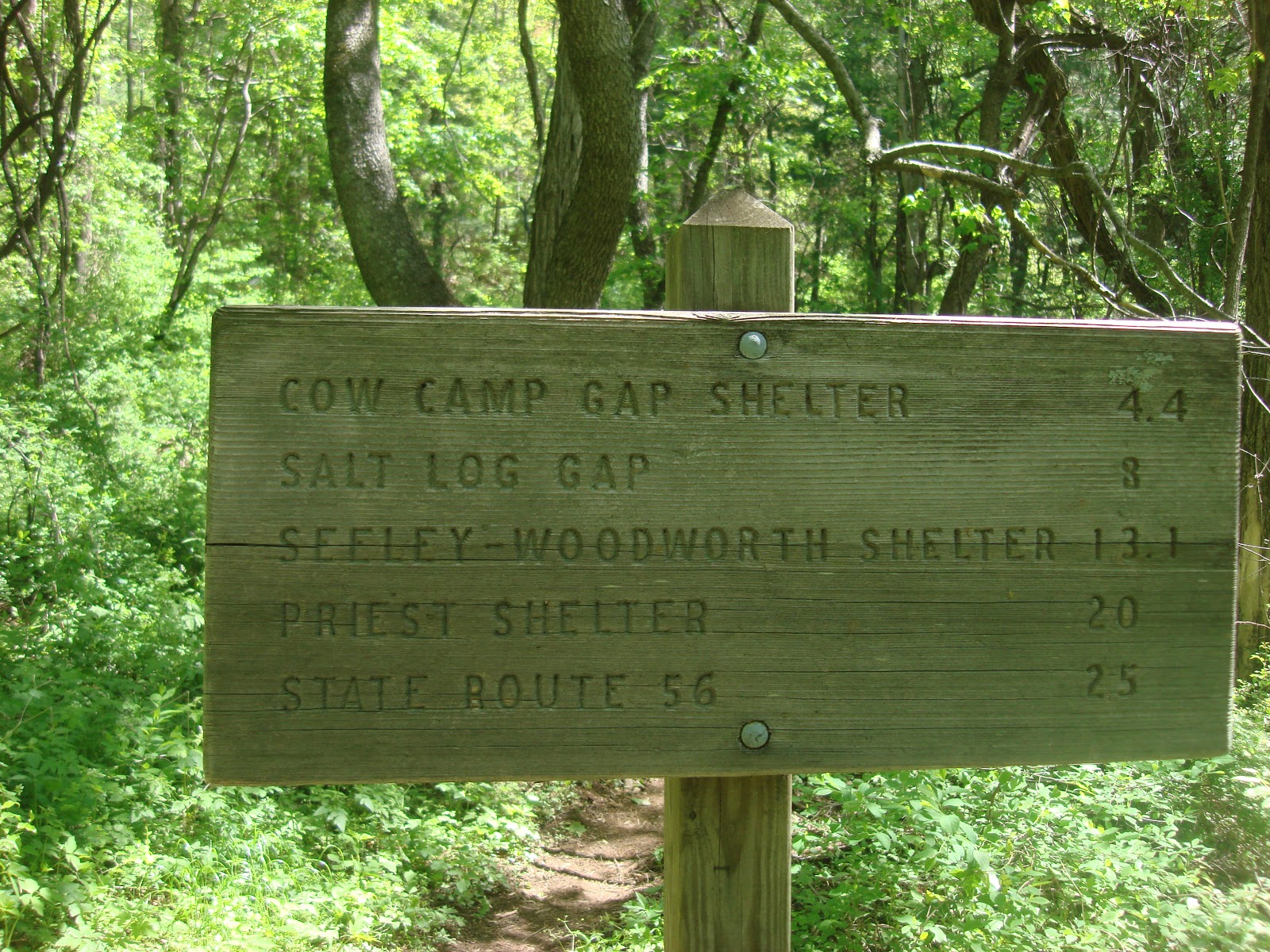
We all hiked gradually downhill until we reached the Cow Camp Gap Shelter, which is an A.T. thru-hiker shelter. We stopped for almost an hour, pumping water into our bottles and bodies, some of us using the only latrine we would see on this trip, reading the shelter's log book (and some adding their own entries) and having a snack.
Then came the biggest climb of the trip, up and over Cold Mountain. The mile long ascent took most boys over an hour, though we were only going from 3,500 to 4,000 feet.
Obligatory group shot at the top of the mountain.
At the top we hung out and talked to other hikers. One woman was section hiking and asked us immediately where we planned to camp. She said she'd had bad experiences with Scout troops in the past, so she's wary. But she stayed and had lunch with us when she learned we did not plan to take over an A.T. hut and when we offered to save her from pumping water by refilling her canteen. She was a great source of information about what works and doesn't work on long distance hikes - I am always interested in the opinions of folks who have the real experience.
After getting a group shot at the summit, we walked along the meadows back down the mountain to our Saturday night campsite.
There are few miles of trail in Virginia as glorious
as the A.T. over Cold Mountain.
Even the boys enjoyed the views along this part of the trail, despite several hauling overloaded packs that they were ready to drop. We hiked down to the road near our original trailhead, then established camp in an old field across the road. On Saturday night we weathered a few rainstorms and had the honor of witnessing a boy receive his Eagle rank. Sunday morning we packed up our wet gear and headed home. Overall, a great way to spend Father's Day weekend.
Troop 1028's Scoutmaster could not join us,
but no doubt he will appreciate the single file
line of hikers.
he Shaw’s Fork Trail up Shenandoah Mountain starts near McDowell, Virginia, off of U.S. 250 west of Churchville. I had never taken it before because the Trails Illustrated Map I have indicates that it is a combination of roads and trails, which did not seem interesting. But once on the trail it is clear that the roads have not seen vehicular traffic in many years, and it made for a wide, graded trail for the most part, though a couple of areas were unmarked so as to cause confusion about where to go. It would be fun sometime to get a group to take this trail up the mountain, then head north on the Shenandoah Mountain Trail (SMT) for a mile, then go back down the mountain to a car drop at the Georgia Draft Trailhead on U.S. 250 just east of Ramsey's Draft for a hike that would total around 9-10 miles.
Lines were hissing and popping where the Shaws Fork Trail
met the Shenandoah Mountain Trail.
Instead of heading north on the SMT, I went south when I reached the ridge top. I had started out from Charlottesville very early, was on the trail at about 8:30, and it was only 10:45 AM when I got to the top of the mountain. Not late enough, so I thought I would head south on the SMT to at least Tims Knob (3560’). Maybe there is an overlook. Then I’d see how I felt, and if things were going well, consider making a loop with another trail to get home by mid-afternoon having completed a hike of about 14 miles. A notice on the signpost back at the trailhead suggested this as a nice loop for horses, and the horse trail up the mountain had been great.
At Tims Knob was the most spectacular display of Turkeybeard I have ever seen – hundreds of flowers glowing all over the place! It kept me going strong and I decided to complete the loop. I tried texting home from here because I had no idea that I would end up on this trail when I left that morning and thought someone should know where I was hiking, but the text didn’t go through. Crawford Mountain to the east was blocking me from the towers in Churchville.
Turkeybeard is everywhere on the SMT.
My dog and I were passed by a lone mountain biker a while later. I asked him if we were nearing the road where I would veer off of the SMT and he believed that we were – it was taking longer than I anticipated to make the trip. We did come to a road, and there was a trail signpost there, but the sign was missing. I correctly figured this road was part of my loop, and headed downhill on the road. Coming back up was the same mountain biker. He told me that trail I was seeking was terribly overgrown and full of blowdowns. At this point, however, it was quicker to return by continuing forward, as we had gone more than half way around our loop. And I figured a mountain biker wouldn’t have a lot of patience for a trail with some blowdowns, which would not cause as much problem for us.
Looks like a brand new sign for this trail.
We got to the next trail (which I will call the BRT) and, as you can see from the accompanying photo, the sign marking the trail looked brand new and pristine. A good indicator! And there were bright, unfaded yellow diamonds regularly nailed to trees. Blowdowns were bad at the beginning like the biker had said, but not so bad as to make me think I should have gone the long way back. But I didn’t realize that I was being lured into a trap and what awaited me was the single worst hiking experience of my life – nothing else has come close to my experience over the next few miles.
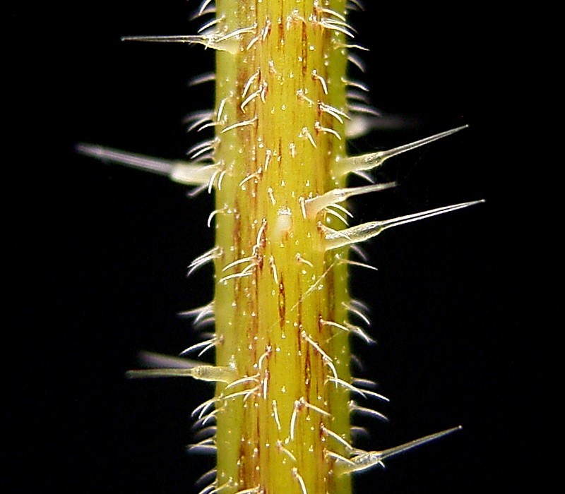
The trail was overgrown at first with ferns, with blowdowns every couple of hundred feet that we had to scramble around. We had to cross the stream at several points, but the blazes sort of made it clear where we had to go and Gracie lapped up the stream water. As we got further in, the ferns were replaced by another plant, which turned this hike into hell. The roadbed was overgrown with 3-5 feet tall stinging nettles (http://en.wikipedia.org/wiki/Stinging_nettle), and there was no discernible trail (other than the flatness of the ancient roadbed used by the trail). They were so thick that I could not see the dog if she was more than about 4 feet away from me. It took me a very long time to slowly make my way through all of these nettles, using my hiking poles to push the nettles away from my body as I slogged through the sea of plants. The pain from the nettles caused me to eventually give up on the trail altogether and instead traverse the slick rocks in the BR creekbed itself to make my way back to the Shenandoah Mountain Trail. I did this knowing full well that one slip on these rocks could be disastrous as nobody would find me down here. There was a substantial number of blowdowns across both the trail and the Run, making the route even more treacherous.
Close up of the Stinging Nettle's stem from Wikipedia.
At one point it occurred to me that I couldn’t keep a very close watch on the trail route from the creek bed. The map showed the trail heading up the mountain to the left from the creek, at a sharp angle, like 8 o’clock on a clock face, if you are marching toward the twelve. As I climbed out, I didn’t see anything that looked like either a trail or a roadbed with the carpet of nettles (they were, I assure you, all over nonetheless) and retraced my steps in the nettles. I hadn’t gotten too far when I saw a bright yellow diamond on a tree ahead. Every bit of travel was difficult and painful, so I looked from a distance around that tree, did not see a trail heading up the mountain, and decided there must be a trail continuing in these weeds somewhere.
A sea of stingers. This IS the trail.
I returned to the creek bed and checked my elevation on the GPS. It wasn’t any help, first because it had turned off (I later determined that it was off for 34 minutes, and I managed to traverse approximately 0.4 miles during this time, which should give you an idea of what I was slogging through), and because it said I already was at 2500 feet, which was the elevation of the road according to the map. Eventually I noticed that the slopes heading up from the creekbed were not as steep as they had been previously, and the nettles did not climb the mountain – they stayed near the creek where there was abundant water. So at 2:45 I decided to go offtrail and head up the mountain heading west. I could come upon the path that goes up the mountain, and failing that could continue to climb until I reached the road. Since the road (FS 396) dead ended heading south part way past the trail, I was taking a real chance here that I had hiked sufficiently north on the trail that I could meet up with the road by heading west. I did not want to think about the consequences if I hadn’t hiked far enough north, however I never felt lost on this hike, even when offtrail. I could always go back the way I had come, but I didn't want to expend the time or effort.
We headed uphill and after only six minutes came to a trail. What a feeling! It headed southwest in the same direction as the trail exiting the river, so we followed it southwest towards the road, even though this took us away from the area we eventually wanted to reach. Combined with the fact that there was an occasional yellow diamond, I was confident I’d made the right choice and I would soon meet up with the road that would cut back north to an intersection with the Shenandoah Mountain Trail. After about 15 minutes, however, the trail cut back east, dropped precipitously, and the GPS showed me going in a circle back down to the streambed! It became clear that I had found the road and taken it back south, rather than finding the trail on its way to meet up with the road. Looking again at the map, there is a section of the road that exactly parallels the trail, and I must have reached the road at that point.
I turned around, took the road(trail) and 39 minutes after first finding the trail hiked past where we had originally picked it up. Heading north, the road/trail edged closer and closer to the stream (at this point not marked on the map as a stream at all) until I was back in a sea of stinging nettles once again. At least it didn’t last too long this time. Looking at the map again today, it is clear that the streambed eventually merged into the road so I should have just followed it as far as possible. But I was too tired and frazzled to look at the map closely enough to determine that at the time.
Tired and in wet boots, I made my way back to the Shaws Fork Trail where I tried unsuccessfully to call home at 4:15 PM, almost exactly 5 ½ hours after last passing the same intersection. We made it back down without incident except for the dog running off at one point after some critter (showing more energy now than at the beginning of the hike and causing me to add to my mental list of additional ways the hike could suck even worse than it did so far: 1. Lightning strike; 2. Lost keys to the car or the car was gone when I returned; 3. Lose my iPhone from its clip on my pack’s belt; 4. Dog runs off in the woods and I have to somehow find her). It took us 90 minutes to return from the SMT.
The Shaw's Fork Trail is a very pleasant hike.
Especially after the BRT!
I ended up hiking just over 20 miles in 9+ hours. It is officially the longest hike I have ever taken. Total elevation gain: 4347 feet. I should note that I was not wearing shorts on this hike. Instead I had very lightweight long pants and a long sleeve shirt treated in an insect guard. I almost never hike in shorts anymore, to guard against ticks and chiggers.
That night I Googled the BRT to see if anybody else had the experience. This trail is slated to become part of the Great Eastern Trail, as it provides one of the few reliable water sources along the SMT. (See this photo: http://www.greateasterntrail.net/photo_album/get_photo/Pages/12.html) If so, I’m betting nobody has tried it during the summer.
This map at the traihead promotes the BRT as a legitimate trail.
On the next day I had amazingly little in the way or residual pain, other than a slight headache that I attribute to dehydration, a blister on one foot, and tight calf muscles. The dog has not moved except to eat and spent our dinner under the dining room table wimpering last night.
Elevation Profile
So why haven't I named this trail? I don't want Google searching it. I spoke with someone from the group called the Friends of Shenandoah Mountain, and she told me that mountain bike groups claim the BRT to be a great resource for them, and a reason this area should never get designated a National Wilderness Area (bikes are not allowed in federally designated wilderness areas). Clearly, mountain bikers aren't using or maintaining the trail, and I don't want to give them information that assists them - let them figure it out like I did!
Hike Details PATC Difficulty Factor 425.2 (a new record)
Total Altitude Gain 4347
Total Distance 20.8 (a new record)
Lowest point 2036 feet above sea level
Highest Point 3844 feet above sea level
Time 9 hours, 14 minutes
On a beautiful and cool morning on May 19th, I hiked a couple of sections of the A.T. I had not hiked since back in 1993. I started where U.S. 60 crosses the A.T. U.S. 60 connects Amherst and Lexington, and there is a large wayside at the A.T. called the Long Mountain Wayside. This parking area was 66 miles from Charlottesville, and took an hour and 10 minutes to reach.
Brown Mountain Creek Shelter with an A.T. thru-hiker.
The wayside has an unusual geocache - rated one star for access (so someone on a wheelchair could reach it) and three stars for difficulty (tricky hide). I could not find it! But I came back a few weeks later and located it thanks to a better read from the GPS.
From U.S. 60, I headed south and down the mountain to the Brown Mountain Creek A.T. Shelter. This part of the hike is totally wooded, without views. There is a sign along the trail telling hikers to look for signs of an old community that was down here. People farmed the area until the land was sold to the Forest Service back in the 1920's. Foundations were clearly visible off of the trail.
Gracie the Hiking Dog checks out the bridge
at Brown Mountain Creek.
I spoke with several A.T. thru-hikers at the shelter, and others were camping in the area. The area has great campsites, something I did not remember from my previous hike through here.
After finding a geocache near the shelter I started the long climb back up. The shelter is at about 1500 feet above sea level, and over the next several miles the A.T. climbs up to over 4000 feet in elevation. So this is a long haul hike when started from the shelter, almost as long as the hike up the Priest. I felt my previous inactivity! I was ready to reach the top of Bald Mountain, and was hurting for several days after this hike.
There were lots of hikers on the trail, which was surprising for a Thursday in May. I ran into at least 5 thru-hikers, and a couple of section hikers. I think I was the only day hiker out there. I mentioned my purpose to a couple of section hikers - to check out possible campsites for a Boy Scout backpacking trip - and got some really good advice, as one of them was a leader of a Richmond troop.
Trail sign for northbound hikers at U.S. 60.
And I didn't feel so bad about struggling up the mountain when I came across a thru-hiker halfway down the mountain who asked if we were near the top. She said that the hike was really getting to her that day. And she had hiked there from Georgia!
Trillium in bloom at 3000 feet elevation.
I did not recommend this hike for the Boy Scout Troop, opting instead for a hike a few miles further north that only hikes a small part of the A.T. We will be hiking that section in a few weeks and I'll report on that hike after we complete it.
Near the top of Bald Mountain.
But hiking this section gives me a taste to go back and re-hike sections I haven't hiked in nearly 20 years. Too bad the heat has arrived in Virginia. Today's forecasted 95 degree Memorial Day temps leaves me little incentive to head up into the mountains!
It has been a long time since I have updated this blog, though I have several hike reports in various stages of completion. This is the first one to get finished, even though it is my most recent hike, as I wanted to test out a new camera/camcorder.
I don't understand why Jump Mountain isn't considered among the premier hikes in Virginia. I have great memories of this hike from nearly 15 years ago when I last hiked it. I remember it being steep, with incredible views at the top, and I remember almost walking into a gigantic spider at face level. Ugh!
The Kiosk in the parking lot warns you about the bridge!
I've been pushing this hike with the trail club for over a year, so it made sense to make the hike again so it was fresher in my mind. I brought Gracie the hiking dog with me, and also brought my son's new Flip-type camera, which he received for his 11th birthday. The specs make it appear better quality than either the current camcorder or digital camera I have been using, so I was excited to try this thing out in the field.
The hike starts at a parking lot just west of Goshen Pass. If you have never driven Virginia State Route 39 west from Lexington you need to do so! It is unquestionably one of the prettiest drives in the Commonwealth.
The scariest part of this hike is 100 yards into it. To start the hike, you have to cross a cable bridge over the Maury River. A sign in the parking lot says no more than 3 on the bridge at a time, and don't make the bridge sway. So the bridge was not a lot of fun! Gracie the dog was not keen on that crossing.
After crossing the bridge, the Goshen Pass Trail follows the path of the Maury River with nice views of the water. The river was very high on this hike, sometimes flooding the trail due to rains the past several days. There were some trees down on the trail, and a bridge had washed out over one of the side streams. Eventually the trail became so overgrown that I turned back. I had to hope that I had missed the turnoff for the trail up the mountain, so I wouldn't have to go back to the beginning.
The trail along the Maury River.
That turned out to be the case. Hiking back towards the car I discovered that the Chambers Ridge Trail heads uphill just after a downed tree and before the washed out bridge. This turned out to be the first of several times I lost the intended route on this hike.
The trail split occurred approximately 0.6 miles from the Swinging Bridge and is at approximately N37 56.489 W79 27.145. (The Hikingupward site claims the turnoff is after 0.8 miles. Maybe I should have read this before the hike!) I added another .6 mile and 27 minutes to my hike by missing this turnoff. There is no sign warning of the route change, but the trail uphill is marked by white blazes.
The Chambers Ridge Trail heads uphill at a steep 26% grade for the next half mile. It passes along some cliffs that must see rock climbers, judging from the sign.
And it passes a nice little waterfall before climbing to a ridge and leveling out. I don't remember this waterfall when I hiked in August of 1996, so it may be ephemeral.
Walking along Chambers Ridge gives some views of the mountains on the other side of the Maury River, and the first views of Lake Merriweather to the west. Lake Merriweather is the site of a Boy Scout camp, owned by the DC area council. This camp was the cause of much local controversy a couple of years ago, when the national Boy Scouts of America sought to purchase the property as a permanent location for its quadrennial Jamboree. The BSA pulled out and purchased property near Beckley, West Virginia instead. The Army Corps of Engineers has called into question the long term safety of the Lake Merriweather dam.
On the ridge was a small, brackish pond, then an intersection with the Little Peak Trail. Over the next 0.44 miles, the trail averaged a 30% elevation gain, gaining 700 feet in elevation. This trail literally went straight up the mountain! At one point, Gracie the hiking dog had to wait for me (she hates to do that) to show her how to get up a rock scramble. Here is a jumpy video of that scramble:
Until this point, the trail was inside or along the border of the Goshen Pass Natural Area Preserve. The trail crossed into the Goshen and Little North Mountain Wildlife Management Area at the top of Little North Mountain, where it followed the ridge for a short distance before dropping down into a ravine between Little North and Jump Mountains. Because a trail continues past this drop off to a campsite, it was difficult to tell at first that I was no longer on the main path. I retraced the path back to the point where the trail dropped off of the ridge (N37 56.788 W79 25.798), then quickly lost the trail again. Because I knew where Jump Rock's location, Gracie and I went off trail until we found the trail leading up to the mountain. I later determined that my trail was difficult to follow because of downed trees and leaf cover.
I should note here the warning from the HikingUpward site, which I did not read in advance of this hike because I hiked this route with no problems 15 years ago:
From this point on, the trail and markings get a little sketchy for a good bit of the rest of the hike; which is why we recommend downloading our GPS track for this hike. Without the GPS track the hike can be done if you have a good sense of direction and orienteering skills. Doing this hike with others is also highly recommended. Be alert and try to follow the path as best as possible. Look constantly down the path about 20-30’ to ensure you are still on it.
Near the top of Jump Mountain
We found a trail leading to the top and the view was worth the effort! We reached the top at 12:32, which was 2 hours and 20 minutes after crossing the bridge (including the extra 27 minutes along the Goshen River Trail). Minus the extra mileage, the hike up was 3.6 miles, and my legs were jelly! The view from Jump Rock at 3160 feet is very nearly 360 degrees. It includes the Shenandoah Valley and Great North Mountain all the way to Buffalo Gap. Even Elliot Knob can be seen peeking behind Little North Mountain. Someday I would like to hike the Little North Mountain Trail all the way to Buffalo Gap or even to Elliot Knob.
Little North Mountain and Elliot Knob, looking north from Jump Rock.
We hung out up at the top of the rock for about 15 minutes, enjoying lunch and wondering about a geocache container in clear sight on the rock. There were no listings in this area on the Geocaching.com website, and it was placed inside the apparent boundaries of the North Mountain Wildlife Management Area, which would not be permitted. I looked at it more closely and discovered a big hole in the Tupperware container (a good reason to use the more expensive Army-issue Ammo Can in the backcountry). I attached the Tupper to the outside of my pack and tossed it in the garbage when I reached home.
WMA boundary clearly marked, with geocache on the left.
On the return trip, I found another unmarked trail that went nowhere, but I was hanging tight to my topo map at this point and didn't wander too far off course. I got back onto the ridgeline of Little North Mountain and followed that in and out of the edge of the Wildlife Management Area boundaries. I think the Virginia Department of Game and Inland Fisheries can take credit for the difficulties following the trail. They seem to barely tolerate non-hunting activities on their lands, and my hikes on WMA properties always seems a little like trespassing. I bet they like it that way!
I wonder if these boundary markers glow at night?
I would guess they also discourage trail markers on their lands, but they love to clearly mark their boundaries. Leave No Trace seems to be a foreign concept when it comes to boundary marking for Game and Inland Fisheries. While I can see the need to mark the boundaries of hunting lands, piling a bunch of gold colored rocks on the boundary seems like overkill. It is interesting to note that the Virginia DGIF is seeking right now to change their fee structure so that hikers like me would be charged $3 for the privilege of entering their lands. (Can't really say they are MY lands, as I am sure the DGIF would be happy to tell me.) Information on the fee change is found here. If they want to charge me for using their land, don't I have a right to demand that they properly sign their trails?
Viewing Rock Trail splits off of the Little North Mountain Trail, with Jump Rock in the background.
I continued on the Little North Mountain Trail, following the ridge line until I reached the Viewing Rock Trail. I had coordinates for this trail as a Cub Scout Pack placed a geocache at Viewing Rock. (I am not sure that this is a legal geocache, though it is listed on the website, as it appears that Viewing Rock is within the boundaries of the WMA, and geocaches are not permitted on these properties.) Dropping down to Viewing Rock, there are suddenly lots of signs, with each crediting the Cub Scout Pack that created it.
The view from Viewing Rock was to the west, overlooking the Boy Scout camp. I bet hundreds of Scouts make this trip every summer, and the trail below the rock shows the wear from this use. But the rock itself has a view that makes the scramble up the mountain worthwhile. And the trail to viewing rock is not as steep as the trail I took up to Jump Mountain.
Descending from Viewing Rock, I attempted to follow the same loop that I hiked back in 1996. I took the Viewing Rock Trail to the Hunter's Trail, and intended to take the Hunter's Trail back to the car. At the intersection of the Chamber's Hollow and Hunter's trails, my gut told me that I should follow the Chamber's Hollow Trail towards the Boy Scout Camp. But I wanted to complete the same hike I'd taken in 1996. At some point I lost the Hunter's Trail completely. This was merely irritating, not scary, and I climbed to the top of the ridge I was hiking near, eyeballed the Lake Merriweather dam, then descended the ridge to the Boy Scout camp. From there, I easily found a trail that linked back up with the Hunter's Trail. I was glad I had a topographic map, however, so I could be sure of my general direction at all times. My gut was right - I should have taken the main trail, which is the trail the HikingUpwards guys took.
Near the car was a final Cub Scout sign, set high up on a tree so it could not be easily swiped. I thought it was ironic that a big sign with a bunch of scouts' names would tell me to "Leave No Trace!" It seems like a backhanded way to leave your name on a tree.
To sum up, this hike would be one of the best in the Commonwealth if it were better marked. At the same time, there are some tough climbs, so it is not a hike for everybody. It appears most similar in difficulty to the White Oak Canyon/Cedar Run loop hike I took back in July, 2010.
Will's camera worked great! I think the picture quality was better than what I had been using and I like having both a camcorder and a camera in one tiny package. Maybe I'll save up and get my own.
Details: PATC Difficulty Factor 228.5 Total Altitude Gain 3000 ft. Total Distance 8.7 nukes Low Point 1336 ft. High Point 3173 ft. Time of Hike 5:12
Ramsey's Draft is a federally designated wilderness area west of Staunton and just off of U.S. 250. It is named after the creek, or "draft" that flows through the middle of the wilderness. I have hiked several of the trails in this wilderness area over the past few years, but because some sections of the wilderness are so far away from roads, there are major portions of trail I have never experienced. And since one of my favorite trails skirts the wilderness - the Shenandoah Mountain Trail - I have wanted to get deep into this trail system for a while.
Ramsey's Draft is very dry this time of year.
Normally, this is an overnight backpack trip. That is how all of the guidebooks describe it, and usually they are describing a shorter loop. I prefered not to do this as an overnight and hoped I was still in shape for the hike after this summer's 19 mile Half Dome ascent in Yosemite. I calculated this hike to be a little over 17 miles. I asked a friend who through hiked the A.T. a couple of years ago to come along, and we were on the trail by 10 AM, dressed in orange because you never know when hunting is in season in Virginia. The season seems to be different in each county!
I've been on several parts of this loop in the past where access is straightforward from various trailheads. But parts of this hike are so remote that access is really only possible by backpacking overnight or by a long dayhike. I was excited to experience these parts of the hike.
View from Bald Ridge Trail towards the east.
The loop started near U.S. 250 and the Mountain House Picnic Area. We cut right (east) and ascended the Bridge Hollow Trail for 51 minutes, just over 2 miles, and 973 feet elevation gain before reaching the Bald Knob Trail. The Bald Knob Trail took us along a ridge that, over the next 4.5 miles, took us over or alongside The Peak, Bald Ridge Knob, The Pinnacle, and Gordon Peak.
We briefly stopped at an overlook near Bald Ridge Knob for a snack and to place a new geocache two hours into the hike and just outside the boundaries of Ramsey's Draft Wilderness.
We reached the Leading Ridge Trail at just before 1PM. At this point, we were 6.5 miles into the hike and concerned that we might not have enough daylight to complete the loop. Neither of us had a flashlight, but we elected to move fast and complete the loop before losing light. Maybe one of the campsites near Hiner Springs wouldn't have been a bad option, but we were equipped only for a day hike. Gone was the opportunity to take the one mile side trail to the top of Hardscrabble Knob, the highest point in the wilderness and the 44th highest peak in Virginia. We passed this trail at 2:41 PM, and reached the Shenandoah Mountain Trail at 3:00.
Elevation Profile of the Ramsey's Draft Loop
The Shenandoah Mountain Trail is a wonderfully level trail that constitutes the western edge of Ramsey's Draft Wilderness. We needed a level trail, and moved quickly over the next 5.7 miles, reaching the Road Hollow Trail in less than 1 hour, 50 minutes. The Road Hollow Trail took us back to our car, 2.5 miles by trail. We got back to the car at 5:43, within 5 minutes of total blackness.
Clearly, I'm going to have to get on the trail earlier or choose shorter hikes until we start getting longer days again.
Ramsey's Draft Loop
November 10, 2010
PATC Difficulty Factor 364.9
Total Altitude Gain 3622
Total Distance 18.4
Low Point 2248
High Point 4119
Time of Hike 7:31
Halloween day opened up as a hiking opportunity quickly, and I took advantage to take the dog on a training hike. It also happened to be her five month birthday, and I aimed to get her out for a seven or eight mile trip, after she had performed spectacularly on a five mile hike around Humpback Rocks the week before. I settled on the Rocky Mount/Gap Run loop in the Southern District of Shenandoah N.P. Although I had climbed to the top of Rocky Mount years before, I had never done the whole loop. This is a trail that gets mixed reviews online. On the Hiking Upward site, one user complains that it is just too hard a hike to justify the occasional view, and real, the best view is at the start and end of the hike, from the parking spot on the Skyline Drive. Even the Hiking Upward guys rate this hike a "5," meaning it is one of the hardest hikes in the area, at least in their view. I concur with the position that there are no better views than from the car on this hike. But is that really the point? Whether the hike is worth taking depends on your own outlook, I suppose. I am now a little closer to achieving my goal of hiking every trail mile in that part of Shenandoah, though this is admittedly not a spectacular hike. And there were some nice views and great solitude. I loved the workout. The day was beautiful. And the dog hiked exceptionally well, staying behind me at my feet for 90% of the hike. I don't think the hike justifies a reputation as one of the hardest in Shenandoah. Statistically, it is nearly identical to the White Oak/Cedar Run waterfall loop a few miles north that is very popular - if you go all the way up to the Skyline Drive via the Limberlost Trail, and don't cheat by taking the fire road from White Oak to Cedar Run. These two hikes have very similar elevation gains and hike distances. The difference is that the White Oak loop has all of its elevation gain at the beginning of the hike, while Rocky Mount saves some of its gain for the end of the hike. If you like to limit yourself to an 8 mile hike (as many of us do), the last couple of miles of uphill is not necessarily welcome.
I recommend climbing Rocky Mount first. The hike is not as steep this way, as the steepest section of the trail is a 25% grade on the back end of the mountain. There are some nice campsites in the hollow along Gap Run after you have gone over Rocky Mount, and I doubt there is much competition for these sites. As I returned to the overlook on the Skyline Drive where I parked, a young couple inquired about hiking opportunities in the area. They were just out for the day and clearly new to the area. I did not send them down this trail, but instead directed them to the waterfalls south of Loft Mountain Campground. That sums up this hike for me - it is not the first hike to take in this part of the Park, but it is a nice workout and a great hike for solitude. I thought often on this hike about the last time I hiked part of it. It had to be over 12 years ago, and was with my friend and co-worker Beth. As we hiked, Beth and I swapped stories of our weddings. Beth's family has now expanded to include three children, and there is no parent more devoted than Beth. Beth has taken those children around the world and the family has now settled in New England. The family chose to leave because Virginia laws are not kind to her kind of family. Losing Beth, those children, and Beth's partner is a loss for all of us in Charlottesville.
Rocky Mt/Gap Run Loop October 31, 2010 PATC Difficulty Factor 222.5 Total Altitude Gain 2630 Total Distance 9.4 Time of Hike 3:58 - Posted using BlogPress from my iPad.
I joined a group of folks from Charlottesville for a hike on Sunday. I have hiked with many of these folks through the PATC's Charlottesville Chapter. The parameters of Sunday's hike were that it needed to be close by, and to the south or west of Charlottesville. Two of the hikers wanted to make it to a party that started around 3 PM. And I needed to be home to help my son sell popcorn for the Cub Scouts.
The group was 6 people, which meant we needed to take two vehicles to the trail, but we could handle all hikers in one vehicle for a short distance. So a hike with a car drop became a parameter, because the opportunity presents itself so rarely. And closely connected was the requirement that it be a trail we had not hiked before. There are actually a number of these trails still out there!
We settled on the combination of the Kennedy Ridge Trail and FDR-162, a forest road that is one of the boundaries of St. Mary's Wilderness over by Wintergreen Ski Area. We would drop one car on the Blue Ridge Parkway at the Bald Mountain Overlook (MM 22), and the other on the Coal Road over near Sherando and the town of Stuart's Draft. Didn't look too far on the map, but ended up being about a 45 minute drive from point to point, ultimately adding an hour-and-a-half to the hike and meaning we got back to town later than we'd planned on. Sorry Iva!
On the Kennedy Ridge Trail.
The other end of this hike is on the Coal Road, which heads off of the Sherando Road (Va-664) near Lyndhurst (south of Waynesboro). My old Hiking Guide to the Pedlar District (Second Edition), copyright 1990, recommends taking Va-610 (the Howardsville Turnpike) to Va-660 (Lake Road) past Shenandoah Acres campground. Va-660 becomes FDR-52 at the NF boundary. Turn left onto FDR-42 (the Coal Road) and park at the second road on the right. The trailhead (unmarked) is the third road on the right.
The group chose to hike this from higher elevations to lower, robbing us of true aerobic benefit. This meant that we started out on the Blue Ridge Parkway. FDR-162 is open to traffic, but is so deeply rutted that we saw little use. We were passed by only a couple of vehicles on the hike. Trails from FDR-162 access St. Mary's Wilderness and Sherando Recreation Area, but you have to know where you are, as we saw no trail signs anywhere on this hike except for on one side trail. Campsites and apparent roads head off from FDR-162 at regular intervals, making it difficult to determine for sure where the trails intersect with the road.
Elevation Profile
Fortunately Ken had hiked this road as a part of a circuit in St. Mary's fairly recently (my only experience on the same loop is over 15 years old), and he had some readings on his GPS. The St. Mary's Loop is a popular one (see here and here), which probably accounts for the majority of the hiking traffic on FDR-162. I am glad we had Ken's coordinates, and recommend that anyone trying this hike should have GPS coordinates to make sure they are on the right trail.
According to my guidebook, the Bald Mountain Trail intersects on the left at 0.7 miles. The Torry Ridge Trail intersects on the right at 1.0 miles, and the Mills Creek Trail intersects on the right at 1.3 miles. None of these trails are marked with signs, though the latter two are pretty evident as roads leading towards Sherando. The Kennedy Ridge Trail intersected at a wide spot in the road at 4.1 miles, and shortly after that a rock cairn signaled the Saint Marys River Trail on the left.
Partridge Family or Into The Wild?
The highlight of FDR-162 was the abandoned bus we came across and used for our group photo. There were a couple of campsites with views, but nothing particularly memorable. I liked the bus because it must have a story, though we could not know what it was. Who drove it there? Why was it abandoned? And why did folks bring paint up here to alter its appearance? The bus held tight to answers.
Green Pond in Saint Marys Wilderness
At 4.1 miles we reached the intersection with the Kennedy Ridge Trail and the Saint Marys River Trail. We took a left and had lunch a little ways off of FDR-162, down the St. Mary's Trail at Green Pond. Ken claimed that this is a glacial tarn, but I do not believe glaciers ever touched this part of the country and could not find any support online for this assertion. It appears instead to be a bog. The Pedlar District Hiking Guide states that this is a bog and adds that it had shrunk by one third between 1980 and 1990. It would be interesting to camp here sometime and have a chance to observe the wildlife attracted to this unique location.
Sassafras in Autumn.
After lunch we hiked .3 miles back to FDR-162 and crossed over to the start of the Kennedy Ridge Trail. No sign here, either. The Pedlar District Hiking Guide describes the Kennedy Ridge Trail has having "no special feature to commend it," other than one view from a rock outcrop. Fortunately, Autumn makes any outside trek a great experience. The Blackgum trees had already shed, but the leaves were still crimson on the trail. And the Sassafras trees were turning bright yellow. Parts of the trail looked nearly free of overhead leaves, while others were still so leafy that the trail was still dark.
The single overlook was actually two overlooks very close to each other, and the downhill one had more room. The view was great from there. You can see where the overlook is on the elevation profile, it is the notch to the right of the profile, before we begin a steady descent. I calculated the descent to be 14%. The trailhead is unmarked at the Coal Road, but we came out at these coordinates: N37 58.731 W79 01.536.
Kennedy Ridge Overlook view.
I am not sure I would recommend this hike, though I certainly enjoyed it. The drive between car drops takes a long time. And if I did this hike by myself, I think I would have found it pretty dull. But it was enjoyable for me because of the company and the time of year. And the Kennedy Ridge Trail portion would be a good workout if going uphill.
I am glad I crossed this one off of my list, but doubt I will return anytime soon. I should do the St. Mary's loop again sometime, though. Maybe over the holidays; especially since Devil's Backbone Brewery is on the way home. A great way to end a hike. Thanks, Ken and Marie, for the beer!